
Have you checked out the 2014 Spokane Regional Road Construction Map yet? Well, if you have, you know that we’re now using the ArcGIS Online program to share more information with you. ArcGIS Online allows us to post interactive maps of the projects and programs we work on.
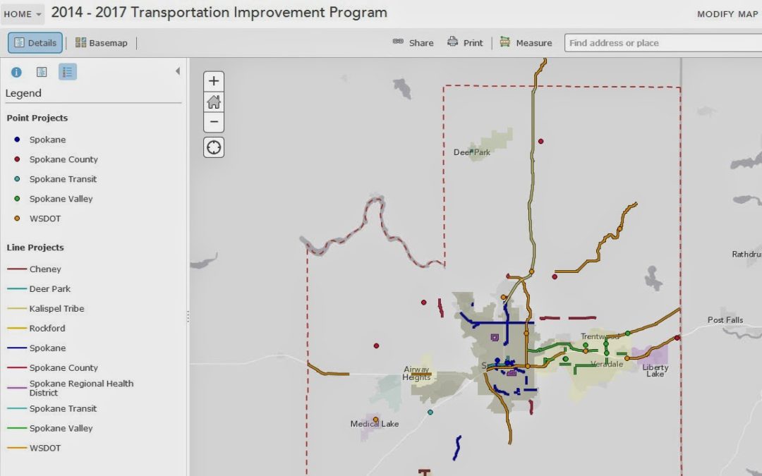
Today, we added a map of projects included in the 2014-2017 Transportation Improvement
Program (TIP). The
map can be found here. The TIP is a planning document
of projects and programs to be completed or constructed in the upcoming
four years in the Spokane region. The TIP map is important because it alerts
people to what is coming up in the short-term future in their neighborhood or
on the routes they regularly use.
Projects are represented on the TIP map as points and
lines with a different color assigned to each jurisdiction that has projects in
the works. Click on a point or line to get the project description,
jurisdiction sponsoring it, and total project cost. Programs and projects that
traditionally couldn’t be mapped, such as those that cover a large area or
provide funds for education campaigns, can be turned on in the contents tab.
Just click the “Non Mappable Projects” box and you will see the area covered by
Spokane County turn dark grey. Click anywhere within the boundaries of the
county and a description of Non Mappable Projects will pop up.
Please
take a moment to check out this map and let me know if you have any questions.
take a moment to check out this map and let me know if you have any questions.
And if you want to read the actual TIP document, it can be found here: https://www.srtc.org/Documents/Documents-Maps/tip/2014-2017_TIP_Files/2014-2017_TIP-Update_121213.pdf